Central Asia is one of the driest regions in the world. Water supply here is largely dependent on mountain rivers. Mountain rivers feed on glaciers. And the river flow regime in the spring and summer depends on the accumulation of snow in the winter months. The volume of melt water from seasonal snow cover in the mountains can be different. Therefore, for the economic development and social security of the region, it is important to be able to accurately calculate this volume.
It is also important to constantly monitor the process of accumulation of snow cover in the mountains, since avalanches can be very dangerous.
How to do this, we will learn today by talking with Abdulkhair Ramazan Zholbarysuly, a leading engineer of the Department of Hydrological Forecasts, Department of Hydrology, RSE “Kazhydromet”.
- Information about the snow cover in the mountains is important for the emergency services of the Ministry of Internal Affairs of the Republic of Kazakhstan, as freshly fallen snow can provoke the descent of dangerous snow avalanches.
Kazhydromet daily publishes a hydrometeorological certificate of snow cover (in winter - from the beginning of the date of steady occurrence of snow cover in the mountains) and sends it to interested bodies and services. The certificate also provides recommendations on the danger of reaching steep snow-covered mountain slopes. In addition, the state of snow cover is also important for the services of GU ‘’ Kazselezashchita ’’.Therefore, this information is needed for the RSE “Kazhydromet” in order to provide short-term and seasonal (for vegetation) forecasts of the flow of mountain rivers.
 Abdulkhair Ramazan
- First of all, for forecasting (calculating) the flow of mountain rivers, data are used from snow gauging routes and snow surveys at weather stations in foothill and mountain regions.
Satellite photosstarted being used relatively recently. Their utility is evaluated by various research centers, including Kazhydromet, and the homogeneity of ground and satellite data is being checked. Automation and digitalization of these procedures is of great relevance.
Over the past decades, remote sensing of the earth has been used. It allows to monitor the spatial distributed snow cover in hard-to-reach regions. Space observations of spatially distributed snow cover significantly improve hydrological models for forecasting runoff.
Available remote sensing products can be obtained from Earth observation satellites with optical sensors. However, optical sensors can only capture snow in areas with clear skies. Therefore, it is very important to accurately assess the presence of snow under the clouds.
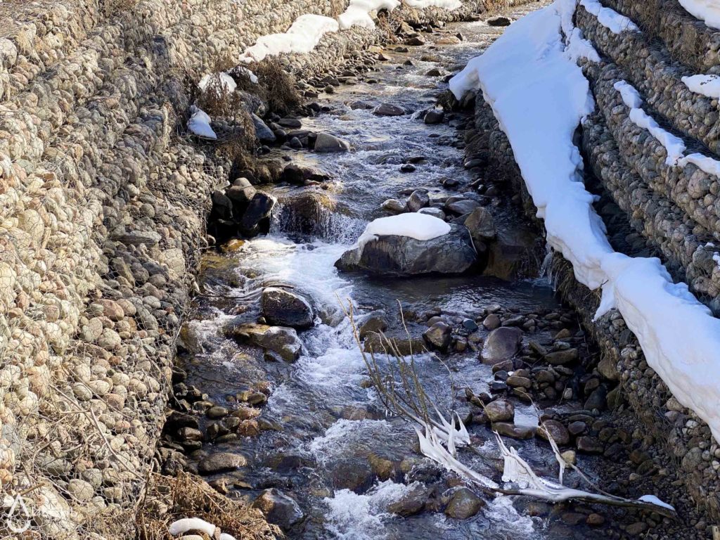
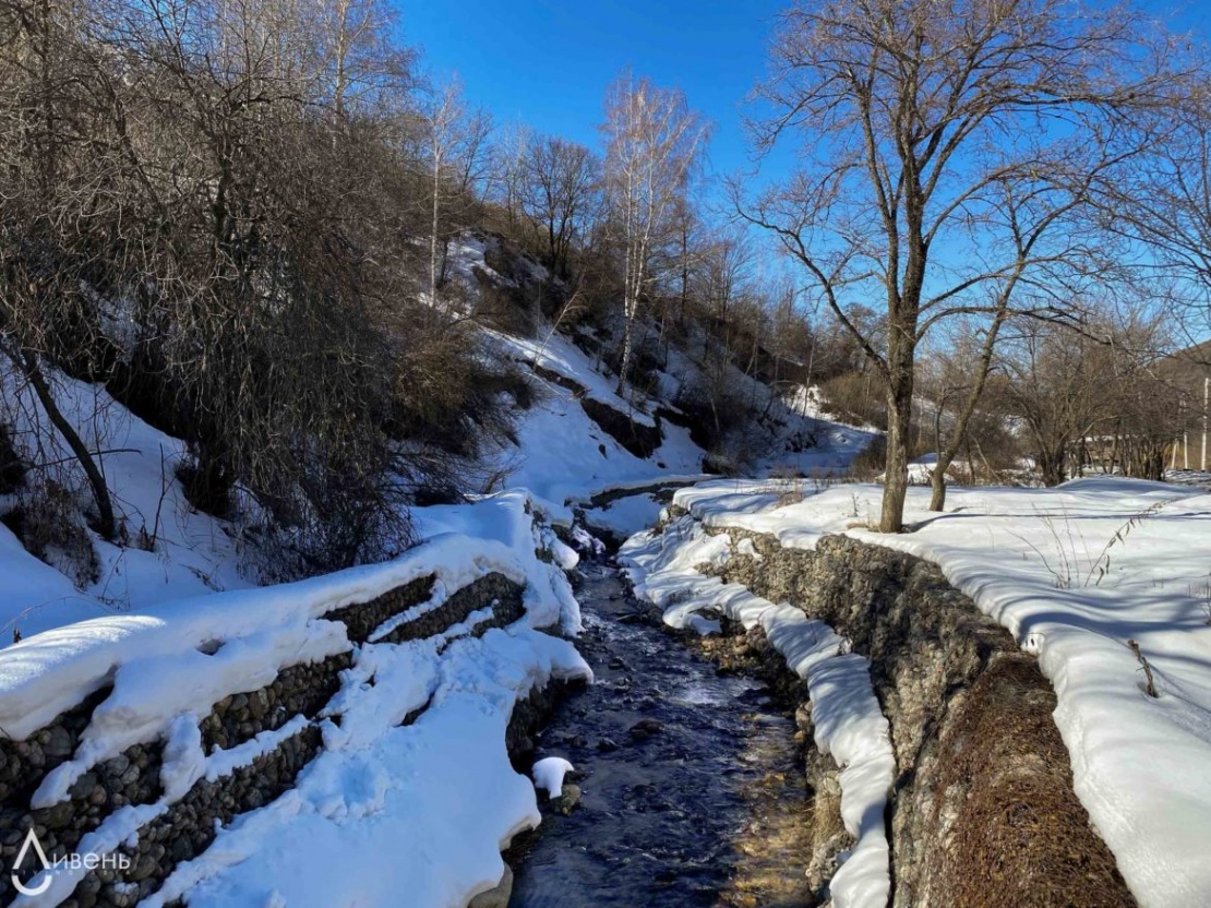
Photo of Butakovka river by Anastasia Fatichowski
- Yes, to reduce or completely eliminate cloud cover from MODIS snow cover images, various approaches have been developed. To solve this problem, the GFZ Land Research Center (Potsdam, Germany) developed the MODSNOW software package. It has been adapted to the conditions of Central Asia. With the assistance of the Regional Environmental Center for Central Asia (CAREC), a training seminar was organized, as well as a software was installed in Kazhydromet.
In particular, within the framework of the CAMP4ASB project, a seminar was held to introduce and implement the MODSNOW model for employees of the Department of Hydrology and the Department of Agrometeorology. During the lectures, methods of monitoring of the snow cover and forecasting river flows, a review of the MODSNOW tool and its results on forecasting the growing season on rivers were discussed. The principles of developing linear models for which data from MODSNOW are used were discussed.
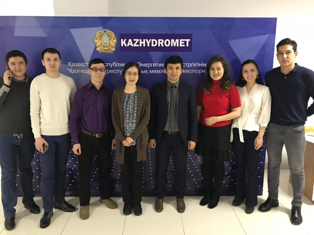 Photo: Kazhydromet employees at the training seminar. In center –AbrorGafurov, employee of the Postdam Research Center.
- To obtain the final result, a snow cover map free of clouds [Fig. 1] and a daily snow cover report [Fig. 2], MODSNOW performs 7 operations:
1. Downloading updated source snow maps from the NSIDC server,
2. Downloading the latest radiation data,
3. Assessment of snow cover using radiation data,
4. Converting source files,
5. ConvertingGeoTIFF files (raster format) to ASCII format (number format), since any operation in programs is based on numbers,
6. Cloud removal (autonomous Fortran program),
7. Post-processing statistics on snow maps.
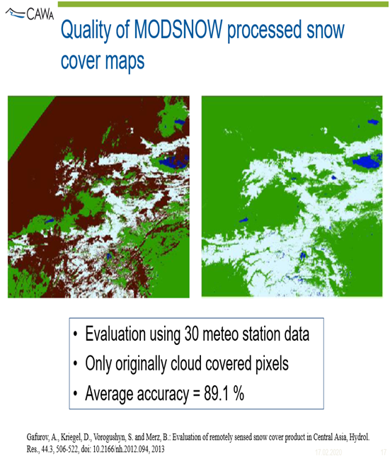
Fig. 1. The result of the image is free from clouds. Brown on the left is the clouds, on the right is the final cleaned result. White color is snow. Blue - water bodies.
The sixth item is the main one in this complex, since the program was developed to solve this particular problem - removing clouds from satellite images and improving their quality.
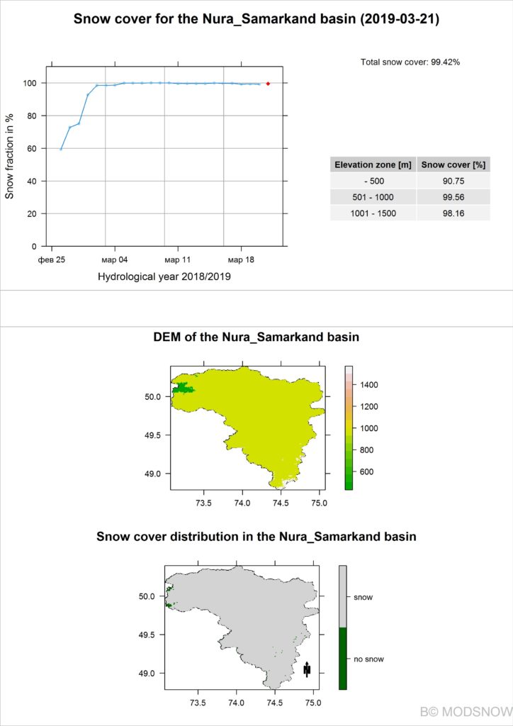
Fig. 2. Daily report on snow cover in the Nura River Basin for March 21, 2019.
The cloud removal algorithm consists of 8 stages [Fig. 3]:
1. The combination of satellite images of Terra and Aqua,
2. Station and pixel approach of conditional probability,
3. The probability of snow (monthly),
4. The conditional probability of the pixel and the virtual station,
5. A temporary combination with a use of cloudless days,
6. The maximum and minimum height of the snow transition,
7. The combination of the neighboring pixel and height,
8. Time series approach.

Fig. 3. Algorithm for cleaning satellite images from clouds, 8 stages.
To a certain extent, each image contributes to cleaning the image from the clouds. For better results, it is important that all steps are completed. The whole process takes place automatically.
- As mentioned, MODSNOW has recently been introduces in Kazhydromet. Therefore, the use of this complex is still limited. During the seminar, a model of the Nura plain river basin (Karaganda region) was introduced for monitoring, which daily provides a report on the snow cover of the river basin (experimentally). Suggestions have been made for further study and improvement of the MODSNOW tool. Work is underway on several mountain rivers of the republic. It is also planned to hold a second seminar in March of this year.
The introduction of such tools as MODSNOW in the near future should greatly facilitate and ensure efficiency for predicting river flow and monitoring snow cover.
- I do not have accurate information, but the training materials are based on the mountain rivers of Uzbekistan and Kyrgyzstan.
____________________
Climate Change Adaptation and Mitigation Program for the Aral Sea Basin